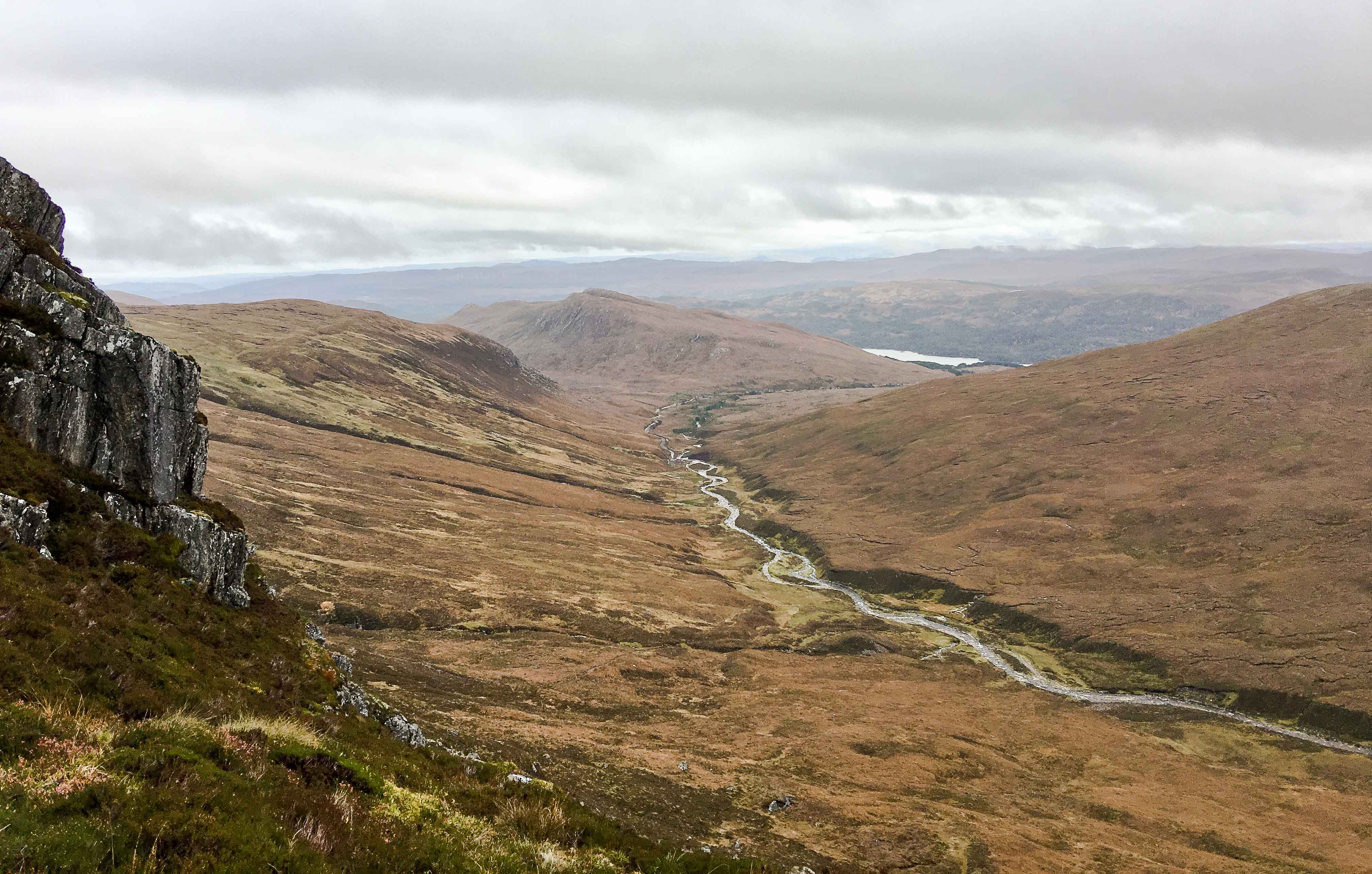
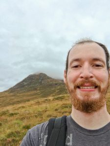
Storytime: I bagged my second Munro a few weeks ago, called Tom a’ Choinich. [A Munro is a Scottish mountain that’s over 3,000 feet high.] The photo above is the view I had from about halfway up the Munro, which was absolutely stunning.
Also: I lost the trail, spent at least an hour scaling the wrong part of said Munro (which was a highly exposed cliffside that made me fear for my life on more than one occasion), nearly got stuck on said Munro since my navigation (phone) failed, and then barely made it off the summit before the winds got too strong and the cloud coverage became too thick to see the trail down.
It was super fun and super scary – I don’t believe my adrenaline has ever been pumping so intensely.
Here’s the full story:
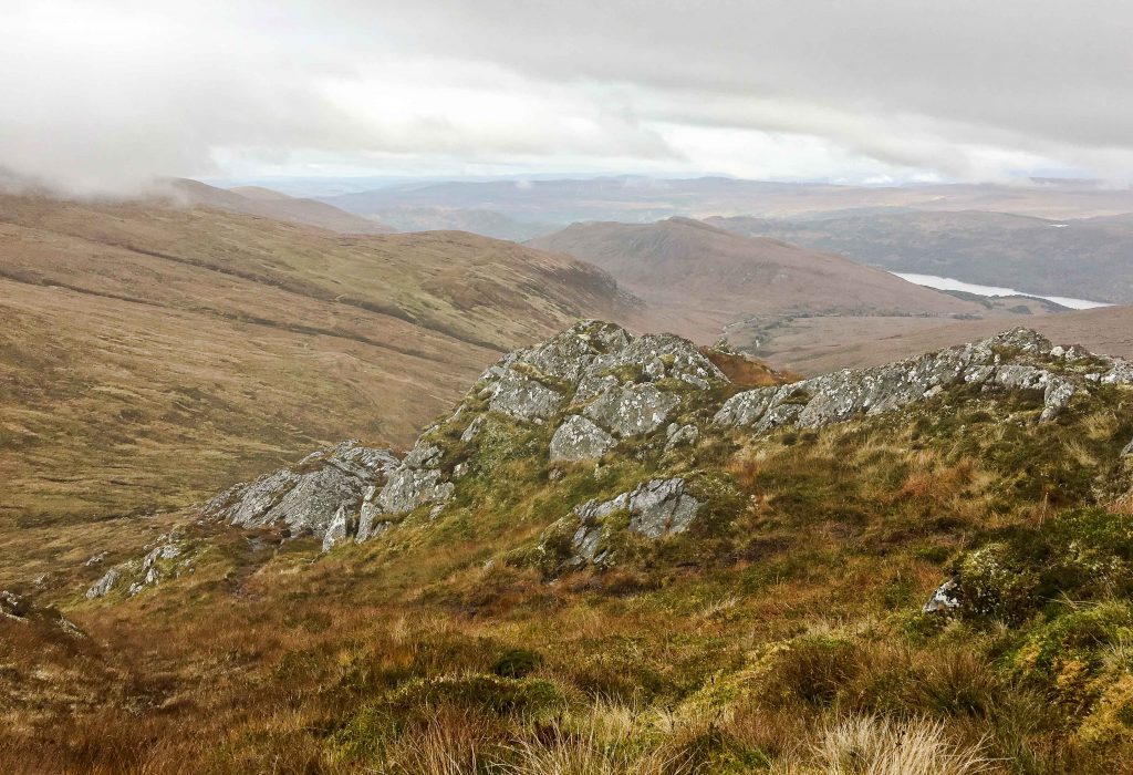
I had rented a car for a holiday [American: “Vacation”] up in the highlands to see more of Scotland’s rugged beauty. [Remembering how to drive a (left-handed) stick-shift while staying on the left-hand side of the road through a million roundabouts and up and down hill after hill on tiny single-lane roads that barely fit my economy car was an adventure of its own. I only turned left onto the wrong (directionally, the “right”) side of a busy road in Inverness and panicked drivers once, thank you very much.] I decided to spend most of my time around the Cairngorms national park and Loch Ness, so I started looking for a few Munros to climb in those areas. I decided on two groups of two Munros (one of those being Ben Macdui, the second highest mountain in the UK) to bring my total up to 5 after this trip.
Mistake #1:” I can hike 4 Munros alone, easy.”
So I set out to research more about each of these Munros and downloaded some offline trail maps to my phone for navigation. I wasn’t foolish enough to think I’d have service when I was hiking, so I made sure I had detailed maps downloaded and a trail to follow with waypoints and all. I also wasn’t foolish enough to think my phone battery would last, so I made sure I had an external battery pack with at least 3 full charges on it.
I was going to start off easy and do Tom a’ Choinich and Toll Creagach (rated 4 out of 5 on www.hillwalking.co.uk) first before trying my hand at the big hill, Ben Macdui, the next day. So I read some reviews of the trails to prepare myself for anything that might come. A couple of reports kept saying that I should never trust my smartphone for directions and always have a physical map and compass. But they obviously didn’t know that I had hiking apps and offline maps and an external battery. I was pretty sure I knew what I was doing…
Mistake #2:” I don’t need a compass – I’ve got offline maps and an external battery.”
Tom a’ Choinich is located west of Loch Ness in a less touristy forest area called Glen Affric (which is beautiful! – I highly recommend you visit it). Tom a’ Choinich means “the hill of the moss,” which makes sense because the base of the Munro is about an hours walk from where the road ends, which is 30-40 minutes walk from where you park your car, and the entire way between there is covered in moss and marsh that you have to slog through. Luckily, I was prepared with the proper layers of clothing and waterproof boots, a waterproof rain jacket, and water-resistant quick-drying hiking trousers [American: “pants” – but don’t use that word interchangeably in the UK, since it means something very different. Especially don’t tell people in the UK that you “got your pants dirty” out hiking. I’m not speaking from experience or anything…].
You can see the start of the hike above with the end of this dirt construction road. Tom a’ Choinich is the mountain on the left covered in clouds, Toll Creagach is on the right. I was planing on bagging both that day. It was at this point that I passed a few hunters coming back – the last people I saw that day.
Mistake #3:” I don’t need to let anyone know where I’m going and when I plan to be back. I’ll be fine on my own.”
I forgot to mention that it was around 1pm, and the sun was going to set around 6:30pm. The hill walking guide online said that the trip would take 6-8 hours, but I figured I could do it in 5 or so. I’m awesome like that. I hike and stuff. I’m an American.
Mistake #4:” 6-8 hours is an estimate. I hike faster than most people since I have long legs. I can start later in the afternoon if I want.”
So I set off across the mossy field before me, making my way towards the base of the Munro. Every once and awhile I checked my phone to see if I was close to the trail, but I figured it didn’t matter if I followed it exactly because I could easily see the base of the mountain and could always find the trail later. Also, since the recent hurricane had swept over the UK the trail was all muddy, so blazing my own trail was easier and drier (“more dry”?). I typically like sticking it to the man and going off trail anyways.
Mistake #5:” I can make my own way. I’ll find the trail later.”
When I finally got to the base of the mountain and started ascending, I realized that I actually hadn’t seen the trail at all since I started. But I wasn’t too worried because I was making pretty good time already – I could always find the trail later. And I had my app that was working even without cell service – I knew exactly where I was, and I could easily see that I just needed to adjust my course a little to meet up with the trail. So I started up the mountain and figured I’d just slowly merge with the waypoints further up. I was also captivated by the view as I kept turning around and taking photos, like the one at the top of this post. It was stunning, and I was really enjoying myself. This Munro bagging thing was fun.
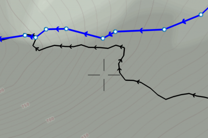
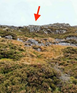
As I kept hiking, I noticed that I was staying the same distance away from the trail instead of merging with it, like I’d planned. The blue line is the trail and the black line is my path. You can see that I was actually on the more exposed side of the mountain with a steeper incline. It started getting to where I was more scaling than hiking, but I had to go straight up to get to the trail – so I kept at it for about an hour. I kept saying, “slow and steady” in my head since I felt pretty exposed. In this next photo, I was supposed to be at the top of that ledge where the arrow points – at least thats what I imagined, since I could’t really get there easily. At this point, my phone was at 20% battery life and the clouds were beginning to roll in, so I figured that I’d rest a bit, get some water and food, and charge my phone with my external battery before I kept scaling up to reach the path.
 Now, normally I carry 3 extra cables in my backpack in case one doesn’t work, but I had left one in my car and one in the hotel, so I only had a newer one that I hadn’t used yet. To my horror, when I took it out and plugged it in, my phone didn’t start charging. A little bit of panic settled in, since the clouds were rolling in and I could no longer see further than 10-20 feet ahead. Going back down blind was possibly more dangerous than going up, I thought. If I slipped I would definitely have fallen a few hundred feet, and fear started settling in. I realized that I needed to get to the trail fast and to do that I had to go straight up the mountain.
It was amazing how much adrenaline hit me right then. I had enough food and water for at least another day, and I had extra clothes to stay warm, but I didn’t have any shelter or light.
Mistake #6:” I don’t need a light, emergency gear, or emergency shelter since I’m just doing a day hike and will be down before dark.”
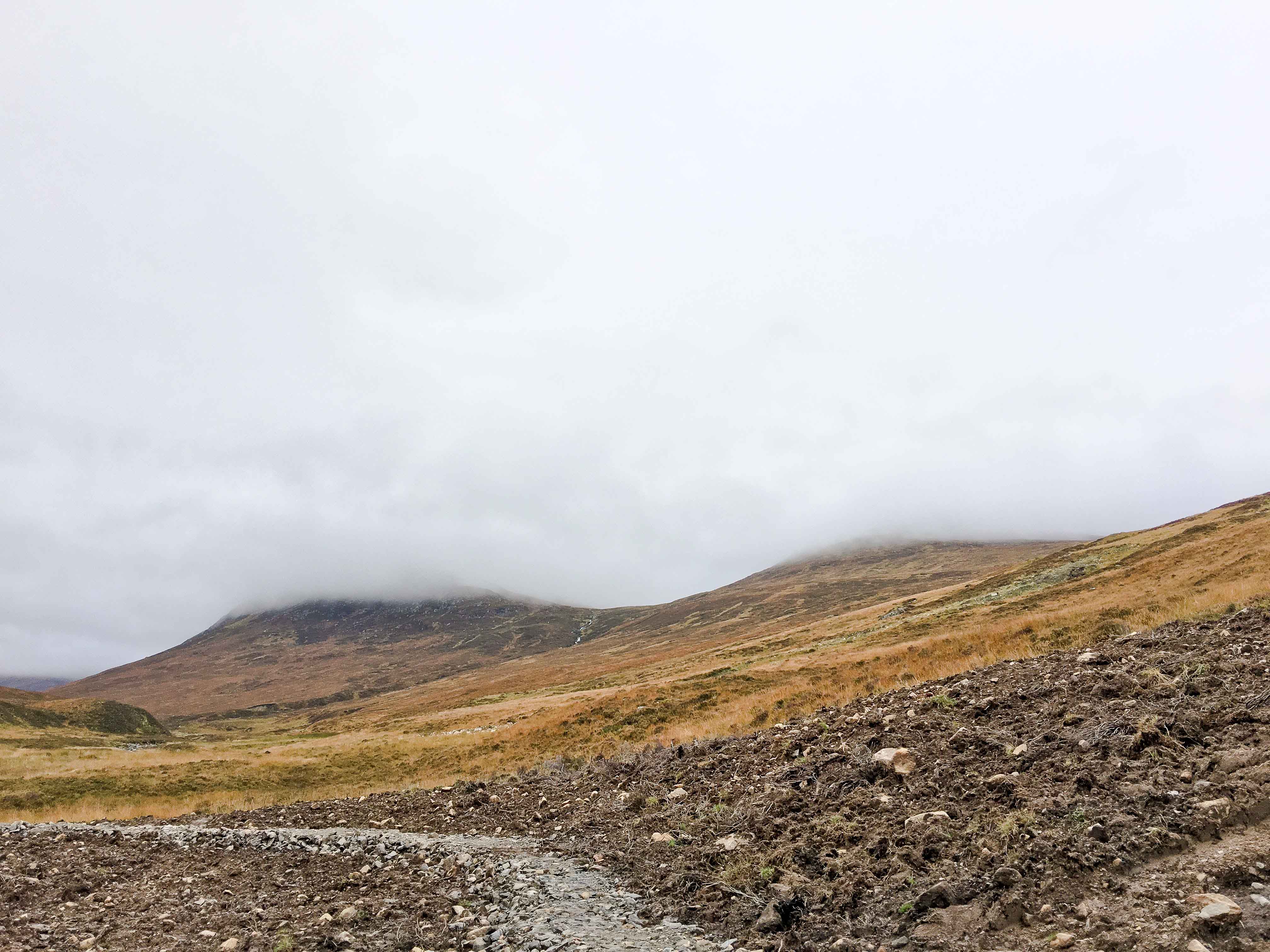
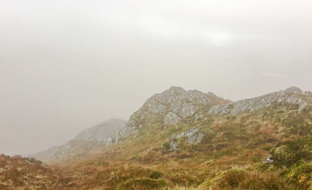
Right then, I realised [American: “realized”] that if I didn’t find the trail soon I would be spending the night on the mountain or slowly sliding down on my bum for who knows how long. I got a burst of energy and you can see on black line on the map that I hoofed it straight up for a while. My switch from “slow and steady” to “get up that mountain or get stuck on it” made me determined to scale straight up, and I finally found a way over the ridge. I can’t tell you how relieved I was to finally find the trail and get shelter from the wind and exposed side of the mountain. I popped into this little dip over the ridge, collapsed on the ground, and thanked God profusely that I’d finally found the trail. You can see on the two photos below how much the clouds had blocked my vision – that’s the same location just 15-20 minutes apart. That’s Scottish weather for you, and what makes hiking the Munros and hills in Scotland so dangerous – the weather can change in minutes.
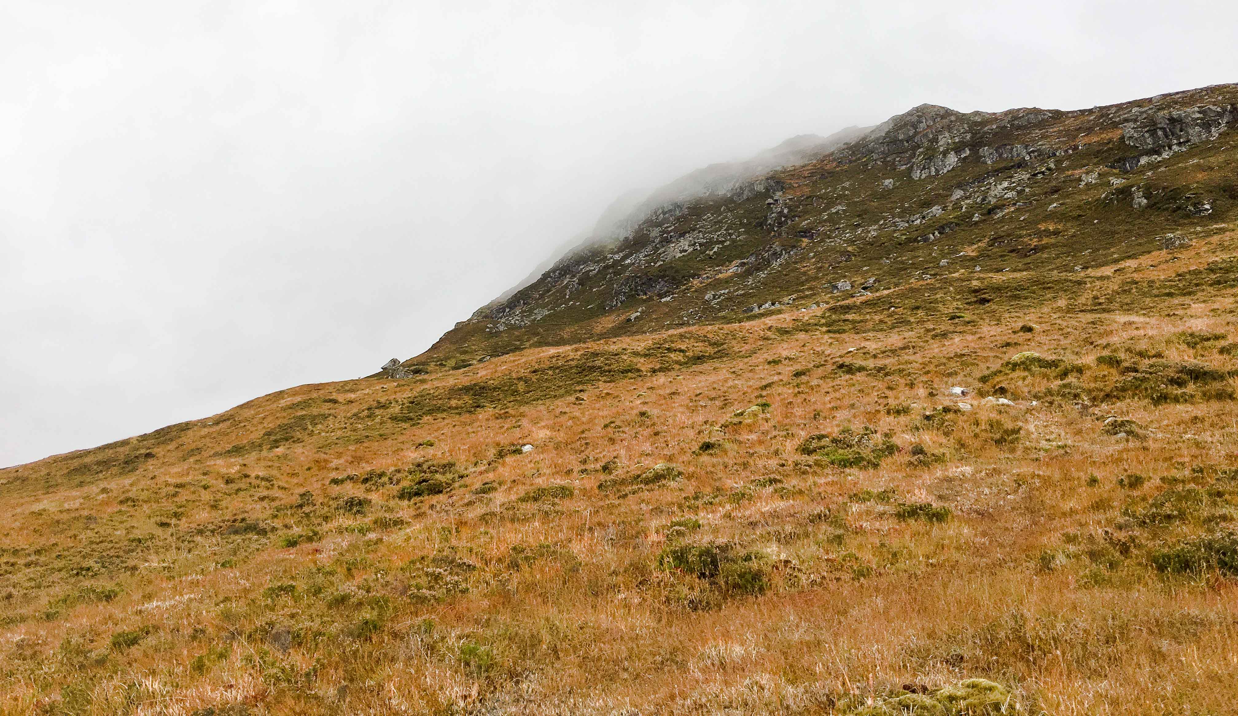
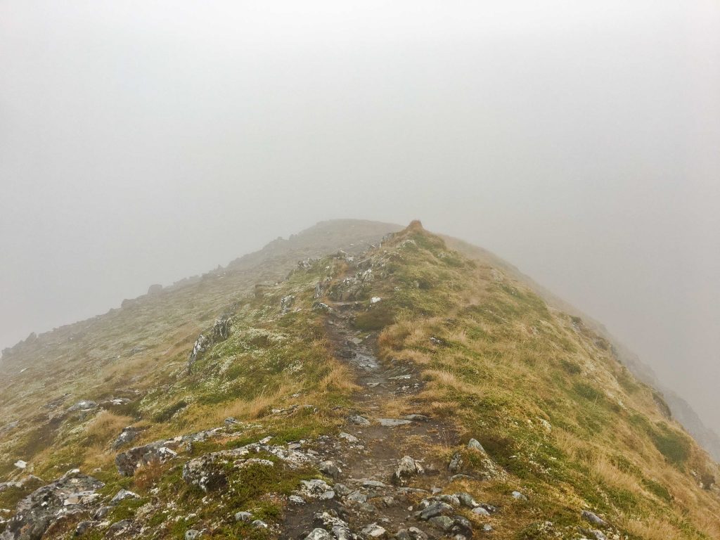
Luckily, when I sat down and tried to charge my phone one more time it started working, and I was able to rest and regain energy while my phone made it to 60% battery life. I was so happy and thankful right there, but I knew I needed to keep moving before losing light. When I went to unplug my charger the cable broke, and I felt panic creep in again. I was still only 2/3 of the way up the Munro and had just found the trail. I had no idea if I would lose it again or not, and I only had 60% battery left to find out. So I set off again, and while the trail made this SO much easier than blazing my own path, there were still some times that the cloud coverage made me nervous and feeling exposed, like the photo below.
I lost the trail a couple of times more, but with my phone charged I was able to find it again. Only as I got closer to the top my phone started losing battery rapidly as the wind grew and it got colder with the altitude. By the time I reached the summit I was at 7% and dropping, and it was starting to rain and the wind and cold were picking up even more. My phone (and hands, since my gloves were wet) also was too cold to get a photo of the summit since it started to freeze, and I didn’t want to wait around since I had no idea what the path down looked like.
The way down was lots of exposed switchbacks, but at least the trail was well defined and easy to follow. I was down to 1% battery at this point. There wasn’t anything to block the wind, though, so I had to sit down several times to keep from being blown off the edges. The original path I planned on walking would take me down the saddle of Tom a’ Choinich and over to summit Toll Creagach (which is the easier Munro to hike of the two), but I decided not to push my luck and become a statistic for stupid-American-hill-walkers. I just cut straight down to the valley below and hoped I could find my way back without a map. To a make a long story short[er], I made it back to my car just before the sun set. You can see how happy I was to make it down to where I could see again.
Ironically, my phone stayed at 1% battery all the way back to the car and never died. Not sure whether that makes me happy or frustrated with Apple. The quick drop in battery life nearly gave me a heart attack twice over on the mountain. I also have a complaint to file with the maker of that phone charging cable, which will make for a fun Amazon review. But mostly, I was glad to be back in my car and relieved that the worst of my concerns for the rest of the night were the dozens of roundabouts I’d have to navigate in Inverness to get to my hotel.

So, the moral of the story:
Make sure you buy a good iPhone charging cable that won’t break like this one.
Heh… Not really. Perhaps these Scots and hill walkers actually know what they’re talking about, and I should have listened to them and taken their advice that I so blatantly ignored. But I would have missed out on the thrill and adrenaline.
I imagine there’s a sermon illustration or two in here about listening, being prepared, and the importance of following the path…